***UPDATE #3***
August 4, 2016 – 12:35 p.m. MT
The tornado watch for Lloydminster, Vermilion, Provost, and Wainwright is no longer in effect. Environment Canada has lifted the advisory; there is a severe thunderstorm warning for these areas still.
Severe thunderstorm warnings are issued when imminent or occurring thunderstorms are likely to produce or are producing one or more of the following: large hail, damaging winds, torrential rainfall.
Environment Canada meteorologists are tracking a line of severe thunderstorms capable of producing up to nickel size hail and heavy rain.
This line of thunderstorms is located from 15 km southeast of Beauvalton to 5 km south of Kitscoty and is moving very slowly.
Heavy downpours are likely to cause flash floods and water pooling on roads. Remember, severe thunderstorms can produce tornadoes. Avoid driving through water on roads.
————————————————————-
***UPDATE #2***
August 4, 2016 – 12:20 p.m. MT
A tornado watch remains in effect for Lloydminster, Two Hills, Dewberry, Kitscoty and Marwayne, Vermilion, Provost, Irma, and Wainwright.
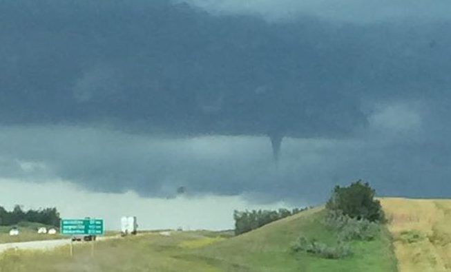
Citizen reports coming in regarding funnel clouds spotted west of Lloydminster, south of Blackfoot; and another report of funnel clouds near the Mount Joy Ski Hill area: south of Kitscoty on Highway 619, in between Paradise Valley.
————————————————————-
***UPDATE***
August 4, 2016 – 12:11 p.m. MT
The tornado that prompted the initial warning for the Town of Vermilion and the County of Vermilion River has dissipated.
However, reports have come in of people spotting funnel clouds approximately 12 kilometers south of Lloydminster, as well as experiencing heavy rain, thunder and lightning near Mount Joy Ski Hill.
————————————————————-
A tornado warning is in effect for the Town of Vermilion and the County of Vermilion River.
As of 11:40 a.m., Environment Canada meteorologists have been tracking a thunderstorm that is producing a tornado.
Damaging winds, large hail, and locally intense rainfall are also possible.
This tornado is 4 kilometers east of Vermilion near Highway 16, moving east at approximately 40 kilometers per hour.
It is being classified as a dangerous and potentially life-threatening situation by Environment Canada.
A “Tornado Warning,” versus a “Tornado Watch” is issued when imminent or occurring thunderstorms are likely to produce or are producing tornadoes. One or more weak tornadoes may be occurring in the area. They sometimes appear as funnel clouds with swirling debris near the ground.
Citizens are encouraged to go indoors to a room on the lowest floor, away from outside walls and windows, such as a basement, bathroom, stairwell or interior closet.
Leave mobile homes, vehicles, tents, trailers and other temporary or free-standing shelter, and move to a strong building if you can.
If you are on the road, as a last resort, lie in a low spot, such as a ditch, and protect your head from flying debris.


